
We are a company specializing in the use of artificial intelligence and advanced data analytics to design the smart cities of the future. Our focus is on the study and optimization of urban mobility, including car traffic, public transportation, as well as pedestrian and cyclist flows.
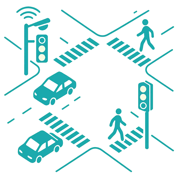
Our strength lies in the ability to collect, integrate, and process large volumes of data from various sources-including municipal systems, sensors, cameras, and transportation infrastructure.
Based on this data, we build precise models that support decision-makers in planning efficient, safe, and sustainable urban infrastructure.
We also conduct our own scientific research, combining expertise in urban planning, traffic engineering, and artificial intelligence.
Our mission is to develop smart tools that grow with the city-adaptive, predictive, and driven by real-time data-to support effective, forward-thinking urban transformation.
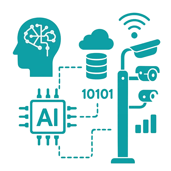
Advanced data collection and integration systems
from various sources (cameras, motion sensors, GPS data, municipal systems), enabling a full view of mobility behaviors in urban space, supporting predictive analytics, real-time monitoring, and optimization of infrastructure and service delivery.
AI - based predictive models
that forecast traffic patterns, the impact of urban investments, and citizen responses to new transport solutions, supporting scenario simulations, strategic planning, and data-informed policymaking in dynamic urban environments.

Research reports and expert analyses
developed by an interdisciplinary team, delivering practical recommendations grounded in hard data and subject-matter expertise, supporting evidence-based urban policies and long-term development strategies.
Decision Support Systems (DSS)
integrating diverse urban data, artificial intelligence, and domain knowledge, enabling real-time traffic management, scenario evaluation, and long-term strategic planning to enhance overall urban efficiency and responsiveness.
Pilot and test implementations
conducted in real urban environments to verify effectiveness, scalability, and adaptability of proposed solutions before full deployment, enabling identification of improvements and alignment with user needs and city infrastructure.
Training sessions and workshops
for public institutions and companies, aimed at strengthening competencies in data analysis, digital urbanism, and the practical application of artificial intelligence to address real urban challenges and support data-driven decisions.
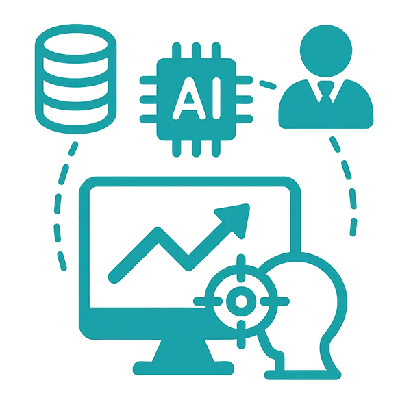
Interactive dashboards and data visualizations
supporting informed decision-making and transparent communication with key stakeholders, including public offices, citizens, and urban designers, while enabling intuitive exploration of complex urban data and trends.

Scenario analysis and traffic simulations
that enable testing diverse urban planning options and evaluating their impact on traffic flow, accessibility, and the overall functionality of the city, supporting better-informed, long-term spatial decisions.
We collaborate with public administration, design offices, universities, and technology companies, offering comprehensive research and analytical support in the fields of spatial planning and mobility. Our services include both data preparation and predictive modeling, as well as the interpretation of analysis results to support decision-making processes.
Thanks to our interdisciplinary approach and the use of cutting-edge technologies – including artificial intelligence, GIS systems, and advanced data visualization – we deliver solutions tailored to the specific needs of cities, regions, and institutions. Our goal is to support the creation of sustainable, functional, and modern urban environments..
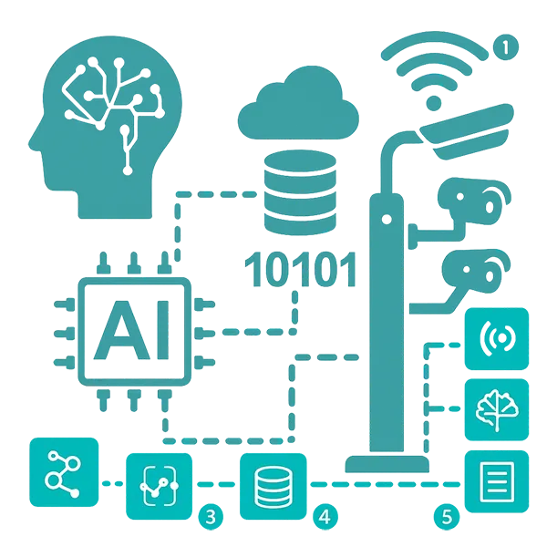
Perception Layer (Data Collection)
Responsible for capturing real-time data from the urban environment using a variety of sensors and detection technologies, this layer gathers information on traffic volumes, pedestrian and cyclist activity, environmental conditions, and urban dynamics.
Transmission and Connectivity Layer
Provides a secure and resilient communication infrastructure that enables fast and uninterrupted data transmission between field-level devices and processing systems, supporting local data processing and maintaining system reliability even during partial failures.
Analytics and Machine Learning Layer
Processes incoming data using artificial intelligence and machine learning algorithms to identify traffic patterns, detect incidents, classify behaviors, and build adaptive predictive models that support dynamic urban mobility management.
Data and Warehouse
Layer
Acts as a centralized environment for integrating, cleaning, and organizing data from various sources, ensuring consistency, quality, and structure needed for effective analysis, reporting, and long-term mobility planning.
Management and Visualization Layer
Delivers real-time monitoring, interactive visualizations, and operational control tools, enabling city operators to manage traffic, respond to incidents, and simulate urban mobility scenarios through a comprehensive digital twin framework.
MOVEON!
AI SmartCity Solutions
Office:
ul. prof. M. Życzkowskiego 12
31-864 Krakow
Poland
We invite you to contact us for more information, collaboration opportunities, or any inquiries.
contact@moveon.city